Android Apps
Polaris GPS Navigation: Hiking, Marine, Offroad
Description
Polaris GPS Navigation: Hiking, Marine, Offroad Android App
GPS for marine, hiking, off road, trail navigation. Unlimited offline maps.Easy-to-use high performance GPS for wherever your travels take you. No account setup or subscriptions required.
Turn your phone into a powerful GPS navigation system with Polaris Navigation GPS, the favorite all-purpose GPS, and dare to go where there are no roads.
Imagine... What would it be like to navigate any waterway or explore any wilderness or city using only your phone's GPS location abilities and a view of the sky? What it would be like to create navigation destinations without the need of an internet connection and find them using only an arrow or offline maps.
That is just a glimpse of the navigational power you will hold in your hands when you install Polaris Navigation GPS.
Used mostly as a hiking, off road, nautical and trail GPS app, Polaris is an excellent backup or replacement for your handheld dedicated GPS satellite navigation unit and will keep you oriented wherever your outdoor adventures take you!
Typical usage:
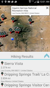
● Hiking GPS with the best hiking maps! Search and find nearby trails.
● Back country exploration and outdoor adventure.
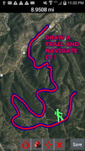
● Record tracks and navigate trails.
● Offroad navigation support for your ATV, Jeep or other 4x4 vehicle.
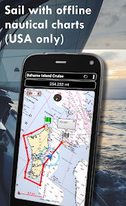
● Sailing / Boating. All marine navigation charts in Polaris are free.
● Fishing GPS. Easily find you favorite fishing hole.
● Hunting and hunting maps. Find you favorite hunting blind and your way back!
● Geocache
● Camping
● Mountain Biking and bike maps
● Backpacking and other outdoor sports
● Compass orienteering
Known for its stability, reliability and flexibility, Polaris is used by land-sea search and rescue, military personnel and millions of others worldwide.
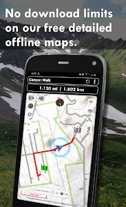
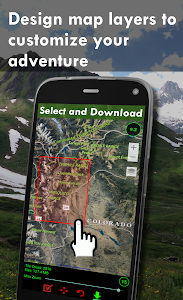
For your offline adventures we provide:
? Unlimited free access to our offline vector & raster maps (topos, marine, hiking and others).
? Offline nautical charts for the USA included (ENC's and raster).
? All maps are shown with high detail and large, easy to read labels.
This powerful navigation system also includes:
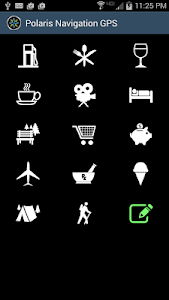
? Polaris Places Picker. Find hiking trails, camping locations and much more!
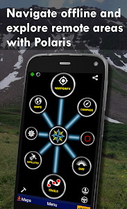
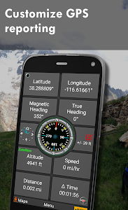
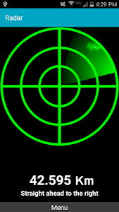
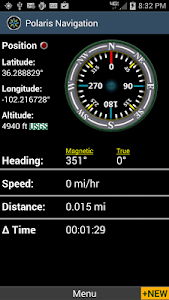
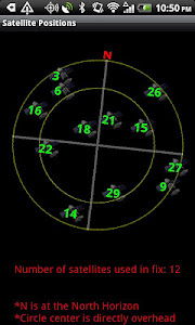
? GPS compass and magnetic compass.
? GPS info panel.
? Odometers, altimeters, speedometers, chronometers.
? Split distances on tracks.
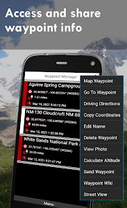
? Connect your waypoints and navigate the track they define.
Map Types:
- Google Maps
- OpenStreetMap-Mapnik
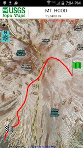
- Topographic Maps
- Cycle Route and Hiking Maps
- Vector Maps
- USGS Topo
- NOAA Marine Charts
- Aviation Operations Charts
- Canada Toporama
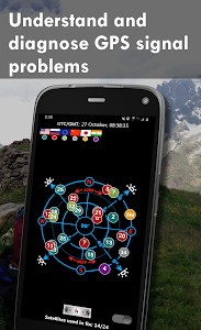
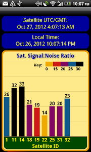
? Comprehensive set of GPS Tools and diagnostics.
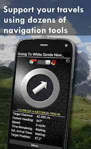
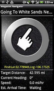
? Waypoint navigation system including a dynamic waypoint-finding compass that always points to your destination while reporting estimated time of arrival, distance to target and other statistics. Just follow the arrow!
? Trail navigation system
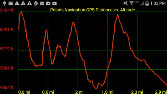
? Altitude profiles
? Location sharing
? Supports British OSGR and OSGB-36 DATUM (Ordnance Survey Grid).
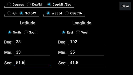
? Coordinate formats: latitude/longitude as degrees, deg:min, deg:min:sec, and UTM (Universal Transverse Mercator)
? Military Coordinate Finder - Military Grid Coordinate Reference System (MGRS)
? Hiking Trails - Most of the maps show hiking paths courtesy of the Openstreetmap project. You will find that even some of the most remote hiking routes are visible on our maps.
⚓ Marine navigation- NOAA Nautical Charts and nautical unit reporting.
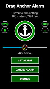
⚓ Drift alert / Drag anchor alarm.
? Select source for altitude reporting: Satellites, United States Geologic Survey or map your location to the results of NASA's Space Shuttle Radar Topography Mission.
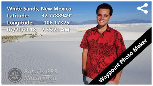
? Waypoint photos stamped with coordinates.
? Road navigation and street directions are provided through a digital pipeline connecting the power of Polaris to the Google Maps app on your device.
* The premium version of Polaris Navigation is called GPS Waypoints Navigator, available on Google Play. GPS Waypoints Navigator is ad-free and contains many other enhancements.
Polaris Navigation GPS
The best GPS navigation system for your Android Info Info
Ratings & Reviews (0)
Review Summary
There are currently no reviews for this app
Submit Your Review
You might also like:

Marine Navigation Lite
599 | TravelGPS Essentials
38K | TravelAPSRTC LIVE TRACK
6K | TravelTomTom GO Navigation
65K | TravelGoogle Earth
7M | Travel


Featured Apps:


Android Apps service is provided by PHONEKY and it's 100% Free!
Apps can be downloaded by Samsung, Huawei, Oppo, Vivo, LG, Xiaomi, Lenovo, ZTE and other Android OS mobile phones.